|
- Philippines Nature and Wildlife
- Biliran Island, The Philippines
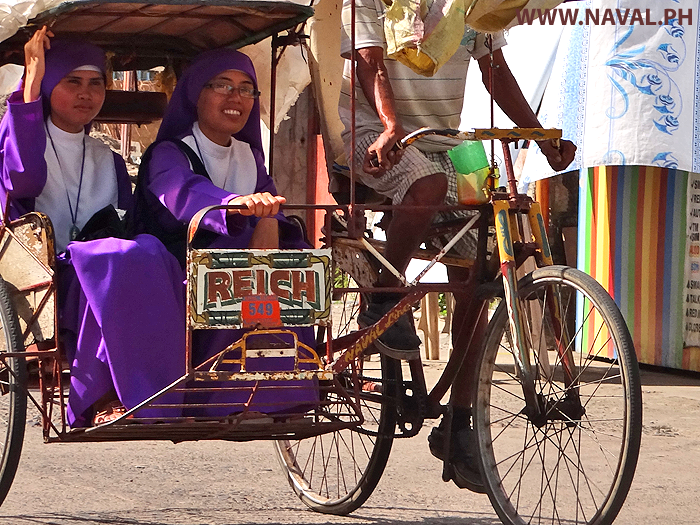
- Naval Biliran Island
- Naval Biliran Island, Hotels, Resorts, Bagasumbol, Tourist Attractions, Leyte Province
- Naval, Biliran Island, Leyte, Philippines
- Naval Business, J&F Department Store, LBC, Prince Superstore, Gaisano
- Pawnshop, Money Transfer, Remittance, Palawan, Cebuana, Western Union
- Cafe, Restaurant, Jollibee, McDonalds, Jelos, Elena, Sophias, Goldilocks
- Banks, Metrobank, PNB, Landbank
- Doctors, Pharmacy, Mercury Drug, Generic, Farmacia
- Hardware Stores, Citi Hardware, Brodeth
- Internet, Electrical, Globe, Smart, Bilinet, Bileco
- Biliran Provincial Government, LGU, Police, Hospital, Electricity
- Naval Municipality, Barangay, Biliran Island
- Santissimo Rosario, Naval
- Padre Inocentes, Garcia Naval
- Calumpang, Naval, Biliran Provincial Capitol
- Larrazabal, Naval
- Sto. Nino, Naval
- Atipolo, Naval, Zero
- Agpangi, Naval, Beach Resort
- Talustusan, Naval
- Sabang, Naval, Beach Resort
- Lico, Naval
- Lucsoon, Naval
- Imelda, Naval
- Capinahan, Naval, Marienor
- Villa Consuelo, Naval
- Padre Sergio Eamiguel, Naval
- Caraycaray, Naval
- Cabungaan, Naval
- Villa Caneja, Naval, Verol Eco Farm
- Libtong, Naval, Hot Springs
- Catmon, Naval, Chamorita Resort, Maylaka
- Borac, Naval
- San Pablo, Naval
- Haguikhican, Naval
- Anislagan, Naval
- Higatangan Island, Biliran Province, Hisfest
- Almeria, Biliran Island
- Kawayan, Biliran Island
- Kawayan Biliran Island, Hotels, Resorts, Tourist Attractions, Leyte Province
- Kawayan, Biliran Island, Leyte, Philippines
- Kawayan Municipality, Barangay, Biliran Island
- Poblacion, Kawayan
- Baganito, Kawayan
- Tabunan North, Kawayan
- Madao, Kawayan
- Ungale, Kawayan
- Kansanoc, Kawayan
- Tubig Guinoo, Kawayan
- Masagaosao, Kawayan
- Burabod, Kawayan
- Inasuyan, Kawayan
- Villa Cornejo, Kawayan
- San Lorenzo, Kawayan
- Tucdao, Kawayan
- Balacson, Kawayan
- Mapuyo, Kawayan
- Bilwang, Kawayan
- Buyo, Kawayan
- Balite, Kawayan
- Bulalacao, Kawayan
- Masagongsong, Kawayan
- Culaba, Biliran Island
- Culaba Biliran Island , Hotels, Resorts, Tourist Attractions, Leyte Province
- Culaba, Biliran Island, Leyte, Philippines
- Culaba Municipality, Barangay, Biliran Island
- Culaba Central, Culaba
- Virginia, Culaba
- Marvel, Culaba
- Salvacion, Culaba, Beach Resort
- Bool East, Culaba
- Calipayan, Culaba
- Patag, Culaba
- San Roque, Culaba
- Bacolod, Culaba
- Guindapunan, Culaba
- Pinamihagan, Culaba
- Looc, Culaba
- Binongtoan, Culaba
- Acaban, Culaba
- Bool West, Culaba
- Bool Central, Culaba
- Habuhab, Culaba
- Caibiran, Biliran Island
- Caibiran Biliran Island, Hotels, Resorts, Tourist Attractions, Canaan Hill Farm, Leyte Province
- Caibiran, Biliran Island, Leyte, Philippines
- Caibiran Municipality, Barangay, Biliran Island
- Palanay, Caibiran
- Palenque, Caibiran
- Manlabang, Caibiran
- Tomalistis, Caibiran
- Binohangan, Caibiran
- Asug, Caibiran
- Uson, Caibiran, Canaan Hill Farm
- Kaulangohan, Caibiran
- Looc, Caibiran
- Alegria, Caibiran
- Maurang, Caibiran
- Villa Vicenta, Caibiran, Hot Springs
- Bariis, Caibiran
- Victory, Caibiran
- Cabibihan, Caibiran
- Kawayanon, Caibiran
- Union, Caibiran
- Cabucgayan, Biliran Island
- Biliran, Biliran Island
- Maripipi Island
- Maripipi Biliran Island, Hotels, Resorts, Tourist Attractions, Leyte Province
- Maripipi, Biliran Province, Leyte, Philippines
- Maripipi Municipality, Barangay, Biliran Province
- Binalayan West, Maripipi Island
- Canduhao, Maripipi Island
- Binalayan East, Maripipi Island
- Casibang, Maripipi Island
- Banlas, Maripipi Island
- Calbani, Maripipi Island
- Bato, Maripipi Island
- Burabod, Maripipi Island
- Danao, Maripipi Island
- Olog, Maripipi Island
- Binongtoan, Maripipi Island
- Trabugan, Maripipi Island
- Viga, Maripipi Island
- Agutay, Maripipi Island
- Ermita, Maripipi Island
- Sambawan Island, Biliran Province