|
|
Biliran Bridge, by Biliran on Nov 5, 2011 23:32:22 GMT 8, Biliran Bridge
Biliran Municipality - Biliran Province - The Philippines
How do I get there?
The Biliran Bridge is the gateway to Biiliran island and Biliran Province, and is its only road connection the the Philippines mainland and Leyte Province.
Biliran Bridge
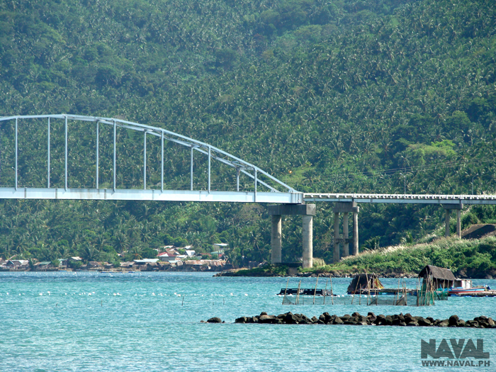
Biliran Bridge
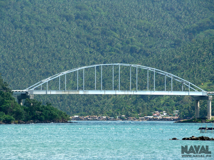
Biliran Bridge
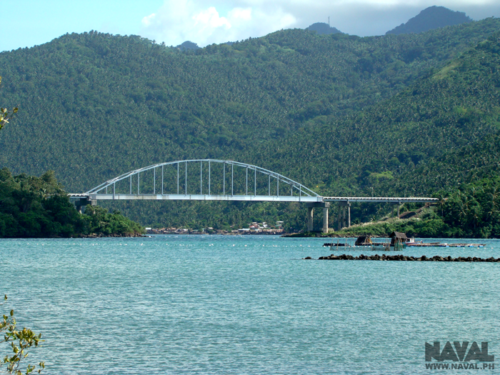
Biliran BiliranBridge Leyte
Biliran Bridge Biliran Municipality - Biliran Province - The Philippines How do I get there?The Biliran Bridge is the gateway to Biiliran island and Biliran Province, and is its only road connection the the Philippines mainland and Leyte Province. Biliran Bridge  Biliran Bridge  Biliran Bridge  Biliran BiliranBridge Leyte |
|
|
|
Biliran Bridge, by Biliran on Nov 18, 2011 2:53:57 GMT 8, www.oocities.org/rolborr/vincrossbridge.html
History crosses bridge in Biliran
By Rolando O. Borrinaga
Biliran Island
(Published in the Philippine Daily Inquirer, October 4, 2003.)
MY FAVORITE historical and tourist spot in the Leyte-Samar region is the southern end of the Biliran Bridge that connects Biliran Province to mainland Leyte.
Completed around 1975, this bridge is about 150 meters long and its central span, held in place by an arched steel structure, hovers above a short and narrow channel of water measuring about 40 meters wide at low tide.
When facing north from my favorite spot, one can view Carigara Bay to the right and the Biliran Strait to the left. From this vantage point, the wind almost invariably blows from the east, from the direction of the Carigara Bay.
During stormy weather in the olden days, outrigger boats sailing along the strait would have to wait for the wind and the sea to calm down before attempting to pass through the narrow channel to the bay, where the waves were bigger and more dangerous to seacraft.
Leyte's roots
It might have been a stormy weather that gave Leyte Island its name. A circa-1590s Spanish traveler, probably a missionary sailing to Carigara from the Spanish settlement in Cebu or Iloilo, might have sheltered on the Biliran side while waiting for the weather to clear up. When he asked for the name of the land across the strait, a probable Cebuano sailor might have answered "Ila-Iti," to refer to the later Leyte-Leyte, which geography included the present Calubian town.
The name was apparently recorded and later got corrupted and evolved into "Leyte".
The first recorded mention of the narrow channel was written almost 400 years ago by Fr. Pedro Chirino, a Jesuit missionary in Leyte, in his monumental work, Relacion de las Islas Filipinas (Rome: 1604). He wrote:
"Panamao [that is, Biliran] is one of the little islands adjacent to this island of Leyte, almost contiguous to it, being separated from it only by a narrow strait so narrow that a ship can barely pass through. It abounds in timber and is therefore suitable for the construction of ships ... and in December of 1601 the ship was here being built on which I was later to sail from those islands [in July of 1602]."
In 1668, Jesuit Fr. Francisco Alcina mentioned a Pogot Point, near a river mouth of Yra-Ete (Leyte-Leyte). Fr. Alcina was probably referring to the southern side of the cut that "beheaded" Biliran from Leyte.
The war years
Around July 1944, the Japanese in Leyte were in the thick of preparations for the return of the Americans. At that time, the 10th Company of the 3rd Battalion, 9th Infantry Regiment, Japanese Imperial Army, had its headquarters in Biliran town.
In compliance with orders (from the battalion headquarters in Ormoc) to stock up rice and food in preparation for the fighting against the Americans, the Japanese company in Biliran put up a checkpoint in the narrow channel separating Biliran from Leyte.
Details of this wartime episode are found in the published memoir of Kennosuke Nakajima, titled Leyte Island: Wandering Between Life and Death (Japan: 1986). Nakajima was a young radio operator assigned in Biliran town. He also joined his company commander in Leyte-Leyte and during an anti-guerrilla patrol in northwestern Leyte.
The first chapter of the memoir was titled "Sunset in Biliran." Nakajima's account of Biliran Channel went as follows:
"... In line with the order from the battalion headquarters, the company commander had a checkpoint set up in the Biliran Channel. Soldiers from our company started to check up the big bancas that sailed through this channel, to search for cargoes of rice and to confiscate them.
"Since Leyte had a large rice-producing area in Carigara, many traders bought rice from the farmers or rice-brokers and transported these to Cebu. The Biliran Channel happened to be the most convenient route for these rice traders. This was the shortcut route for sailing to Cebu. "... In front of Biliran town, a small peninsula jutted out to the sea. The width of the sea was only 500 meters here. So it was quite easy to check the bancas from Biliran town.
Checkpoint
"Several officers and soldiers were assigned to manage the checkpoint. They checked up the bancas that sailed by. Most of the items loaded in the bancas were guinamos, abaca, buwad, and some other daily commodities. But there were also bancas that were loaded with rice. Their rice cargoes were confiscated, in exchange for cash payment of about one-fifth of their actual market price.
"The people in the bancas were really angered by the compulsory exchange of their rice.
"They asked for the prevailing market price in exchange for their goods, since the price set by the Japanese military was so cheap. But we had to follow the order, which also fixed the price for the confiscated rice. So the requests for a fair price were not granted ...
"There were several bancas that tried to flee from the checkpoint. In some instances, the soldiers gave chase and shot at the fleeing bancas and caused injuries to some of their passengers.
"In a few days, all the storage rooms [in the school building once located in the present bus terminal of Biliran town] were filled with sacks of rice. But the bancas also did not sail through the Biliran Channel anymore. Instead, they sailed east of Biliran Island ."
Guerrilla's turn
The Japanese company pulled out of Biliran town for Leyte in early August 1944.
After the Leyte Landing in October 1944, Filipino guerrillas also put up a checkpoint in the narrow channel under the bridge. Hidden behind rock boulders and trees, they ambushed from here a sailboat full of Japanese soldiers, probably the entire detachment assigned to Maripipi. All of the soldiers were reportedly killed.
The foregoing accounts about a narrow geography were written centuries apart by different people from different races.
If you happen to drive across the bridge one of these days, stop your vehicle and get off for a few minutes on my favorite spot. Chances are you will also wonder at the seeming mystery of the surrounding scenery.
Let the feeling be; you are not alone. During less hectic times, people across the centuries were also caught by the same wondrous but unexplainable feeling in the vicinity of the Biliran Bridge.
Some of them wrote down their observations for posterity.
www.oocities.org/rolborr/vincrossbridge.htmlHistory crosses bridge in Biliran By Rolando O. Borrinaga Biliran Island (Published in the Philippine Daily Inquirer, October 4, 2003.) MY FAVORITE historical and tourist spot in the Leyte-Samar region is the southern end of the Biliran Bridge that connects Biliran Province to mainland Leyte. Completed around 1975, this bridge is about 150 meters long and its central span, held in place by an arched steel structure, hovers above a short and narrow channel of water measuring about 40 meters wide at low tide. When facing north from my favorite spot, one can view Carigara Bay to the right and the Biliran Strait to the left. From this vantage point, the wind almost invariably blows from the east, from the direction of the Carigara Bay. During stormy weather in the olden days, outrigger boats sailing along the strait would have to wait for the wind and the sea to calm down before attempting to pass through the narrow channel to the bay, where the waves were bigger and more dangerous to seacraft. Leyte's roots It might have been a stormy weather that gave Leyte Island its name. A circa-1590s Spanish traveler, probably a missionary sailing to Carigara from the Spanish settlement in Cebu or Iloilo, might have sheltered on the Biliran side while waiting for the weather to clear up. When he asked for the name of the land across the strait, a probable Cebuano sailor might have answered "Ila-Iti," to refer to the later Leyte-Leyte, which geography included the present Calubian town. The name was apparently recorded and later got corrupted and evolved into "Leyte". The first recorded mention of the narrow channel was written almost 400 years ago by Fr. Pedro Chirino, a Jesuit missionary in Leyte, in his monumental work, Relacion de las Islas Filipinas (Rome: 1604). He wrote: "Panamao [that is, Biliran] is one of the little islands adjacent to this island of Leyte, almost contiguous to it, being separated from it only by a narrow strait so narrow that a ship can barely pass through. It abounds in timber and is therefore suitable for the construction of ships ... and in December of 1601 the ship was here being built on which I was later to sail from those islands [in July of 1602]." In 1668, Jesuit Fr. Francisco Alcina mentioned a Pogot Point, near a river mouth of Yra-Ete (Leyte-Leyte). Fr. Alcina was probably referring to the southern side of the cut that "beheaded" Biliran from Leyte. The war years Around July 1944, the Japanese in Leyte were in the thick of preparations for the return of the Americans. At that time, the 10th Company of the 3rd Battalion, 9th Infantry Regiment, Japanese Imperial Army, had its headquarters in Biliran town. In compliance with orders (from the battalion headquarters in Ormoc) to stock up rice and food in preparation for the fighting against the Americans, the Japanese company in Biliran put up a checkpoint in the narrow channel separating Biliran from Leyte. Details of this wartime episode are found in the published memoir of Kennosuke Nakajima, titled Leyte Island: Wandering Between Life and Death (Japan: 1986). Nakajima was a young radio operator assigned in Biliran town. He also joined his company commander in Leyte-Leyte and during an anti-guerrilla patrol in northwestern Leyte. The first chapter of the memoir was titled "Sunset in Biliran." Nakajima's account of Biliran Channel went as follows: "... In line with the order from the battalion headquarters, the company commander had a checkpoint set up in the Biliran Channel. Soldiers from our company started to check up the big bancas that sailed through this channel, to search for cargoes of rice and to confiscate them. "Since Leyte had a large rice-producing area in Carigara, many traders bought rice from the farmers or rice-brokers and transported these to Cebu. The Biliran Channel happened to be the most convenient route for these rice traders. This was the shortcut route for sailing to Cebu. "... In front of Biliran town, a small peninsula jutted out to the sea. The width of the sea was only 500 meters here. So it was quite easy to check the bancas from Biliran town. Checkpoint "Several officers and soldiers were assigned to manage the checkpoint. They checked up the bancas that sailed by. Most of the items loaded in the bancas were guinamos, abaca, buwad, and some other daily commodities. But there were also bancas that were loaded with rice. Their rice cargoes were confiscated, in exchange for cash payment of about one-fifth of their actual market price. "The people in the bancas were really angered by the compulsory exchange of their rice. "They asked for the prevailing market price in exchange for their goods, since the price set by the Japanese military was so cheap. But we had to follow the order, which also fixed the price for the confiscated rice. So the requests for a fair price were not granted ... "There were several bancas that tried to flee from the checkpoint. In some instances, the soldiers gave chase and shot at the fleeing bancas and caused injuries to some of their passengers. "In a few days, all the storage rooms [in the school building once located in the present bus terminal of Biliran town] were filled with sacks of rice. But the bancas also did not sail through the Biliran Channel anymore. Instead, they sailed east of Biliran Island ."
Guerrilla's turn
The Japanese company pulled out of Biliran town for Leyte in early August 1944.
After the Leyte Landing in October 1944, Filipino guerrillas also put up a checkpoint in the narrow channel under the bridge. Hidden behind rock boulders and trees, they ambushed from here a sailboat full of Japanese soldiers, probably the entire detachment assigned to Maripipi. All of the soldiers were reportedly killed.
The foregoing accounts about a narrow geography were written centuries apart by different people from different races.
If you happen to drive across the bridge one of these days, stop your vehicle and get off for a few minutes on my favorite spot. Chances are you will also wonder at the seeming mystery of the surrounding scenery.
Let the feeling be; you are not alone. During less hectic times, people across the centuries were also caught by the same wondrous but unexplainable feeling in the vicinity of the Biliran Bridge.
Some of them wrote down their observations for posterity.
|
|
|
|
|
|
Biliran Bridge, by Biliran on Apr 9, 2012 19:54:00 GMT 8, "The Best Place In The World - Biliran, Philippines" ;D
"The Best Place In The World - Biliran, Philippines" ;D
|
|
|
|
Biliran Bridge, by Biliran on Jun 5, 2012 23:56:58 GMT 8, Biliran Bridge.
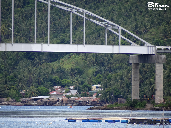
Biliran BiliranBridge Leyte
Biliran Bridge.  Biliran BiliranBridge Leyte |
|
|
|
Biliran Bridge, by Biliran on Jul 31, 2012 1:14:32 GMT 8, 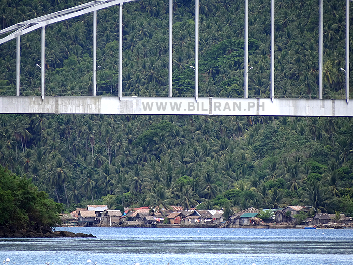
Another view of Biliran Bridge taken from Biliran Town.
Biliran BiliranBridge Leyte
 Another view of Biliran Bridge taken from Biliran Town. Biliran BiliranBridge Leyte |
|
|
|
Biliran Bridge, by Biliran on Oct 12, 2012 16:22:37 GMT 8, 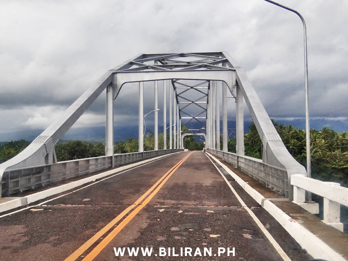
Crossing Biliran Bridge from Leyte Province.
Biliran BiliranBridge Leyte
 Crossing Biliran Bridge from Leyte Province. Biliran BiliranBridge Leyte |
|
|
|
Biliran Bridge, by Biliran on Oct 22, 2012 15:26:03 GMT 8, 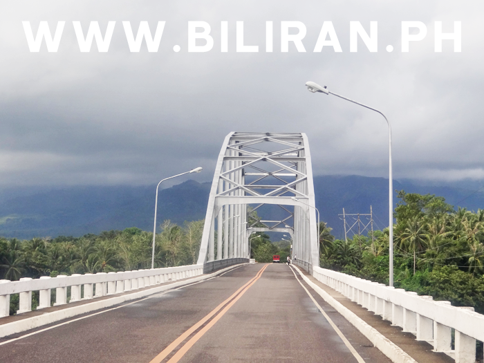
Biliran Bridge.
Biliran BiliranBridge Leyte
 Biliran Bridge. Biliran BiliranBridge Leyte |
|
|
|
Biliran Bridge, by Biliran on Dec 16, 2012 20:06:57 GMT 8, 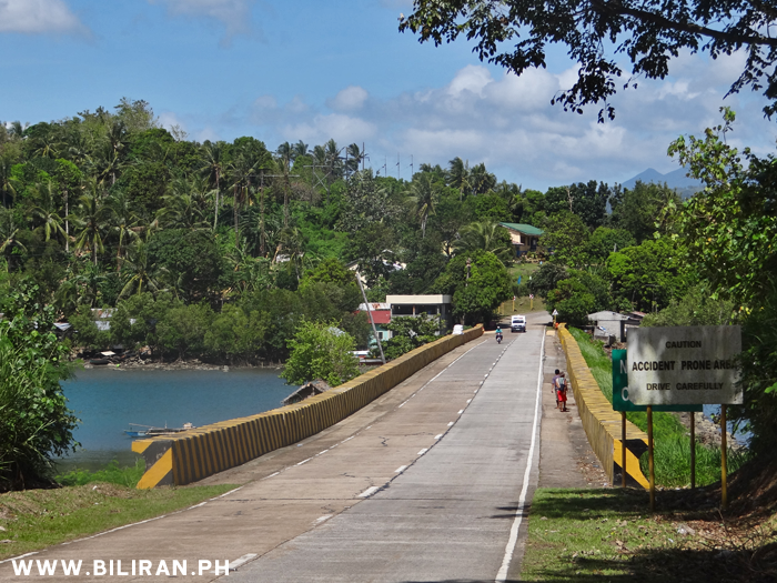
The Nasunogan Causeway after the Biliran Bridge as you enter Biliran Province. In the trees on that small hill on the left is the Nasunugan Watchtower and Chapel.
Biliran BiliranBridge Leyte
 The Nasunogan Causeway after the Biliran Bridge as you enter Biliran Province. In the trees on that small hill on the left is the Nasunugan Watchtower and Chapel. Biliran BiliranBridge Leyte |
|
|
|
Biliran Bridge, by Biliran on Dec 22, 2012 19:54:44 GMT 8, 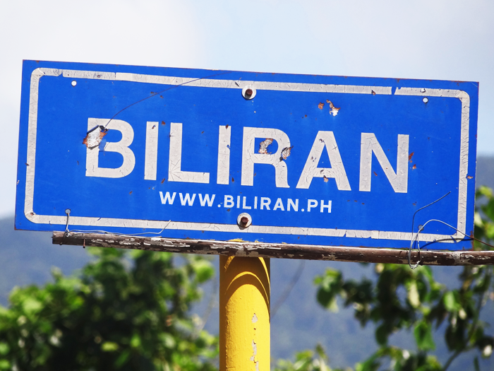
The Biliran road sign as you enter the Island across the Biliran Bridge.
Biliran BiliranBridge Leyte
 The Biliran road sign as you enter the Island across the Biliran Bridge. Biliran BiliranBridge Leyte |
|
|
|
Biliran Bridge, by Biliran on Jan 15, 2013 21:15:24 GMT 8, 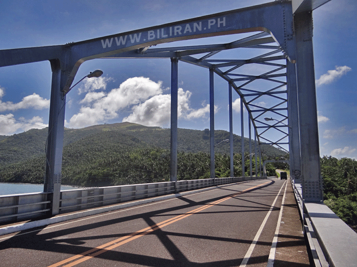
Biliran Bridge.
Biliran BiliranBridge Leyte
 Biliran Bridge. Biliran BiliranBridge Leyte |
|
|
|
Biliran Bridge, by Biliran on Jan 19, 2013 20:05:28 GMT 8, 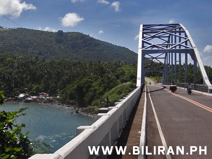
Biliran Bridge.
Biliran BiliranBridge Leyte
 Biliran Bridge. Biliran BiliranBridge Leyte |
|
|
|
Biliran Bridge, by Biliran on Feb 11, 2013 21:26:31 GMT 8, 
Biliran Bridge.
Biliran BiliranBridge Leyte
 Biliran Bridge. Biliran BiliranBridge Leyte |
|
|
|
Biliran Bridge, by Biliran on Feb 23, 2013 20:47:21 GMT 8, 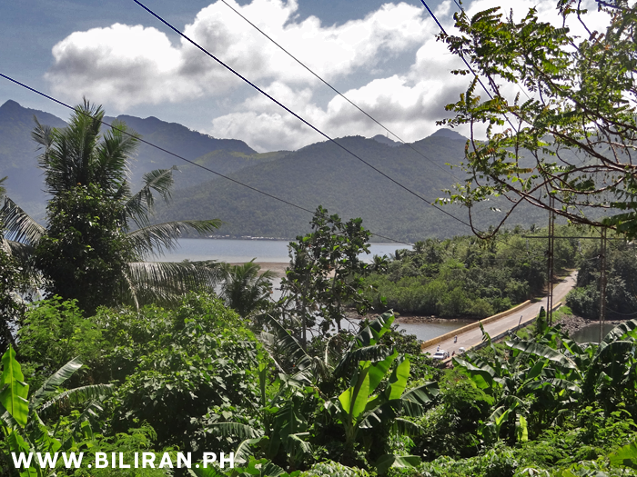
View from the San Roque Chapel of the Nasunogan Causeway going to the Biliran Bridge.
Biliran BiliranBridge Leyte
 View from the San Roque Chapel of the Nasunogan Causeway going to the Biliran Bridge. Biliran BiliranBridge Leyte |
|
|
|
Biliran Bridge, by Biliran on Mar 6, 2013 21:07:09 GMT 8, 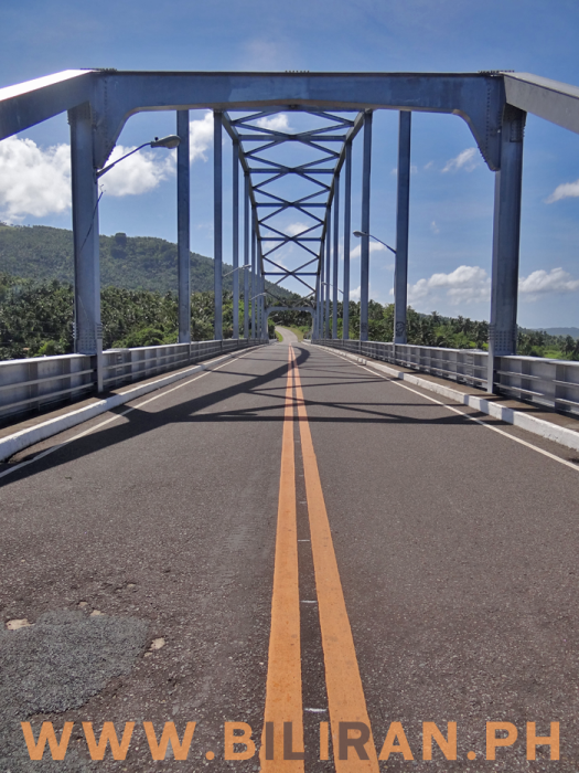
Biliran Bridge and the road going across to Leyte Province.
Biliran BiliranBridge Leyte
 Biliran Bridge and the road going across to Leyte Province. Biliran BiliranBridge Leyte |
|
|
|
Biliran Bridge, by Biliran on Mar 8, 2013 21:09:46 GMT 8, 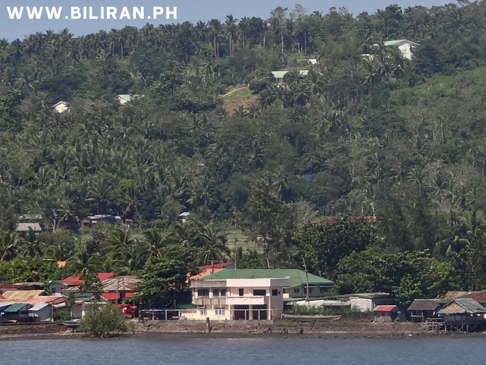
View of Biliran town and the road up to Canila as seen from the Biliran Bridge.
Biliran BiliranBridge Leyte
 View of Biliran town and the road up to Canila as seen from the Biliran Bridge. Biliran BiliranBridge Leyte |
|
|
|
Biliran Bridge, by Biliran on Mar 21, 2013 20:10:28 GMT 8, 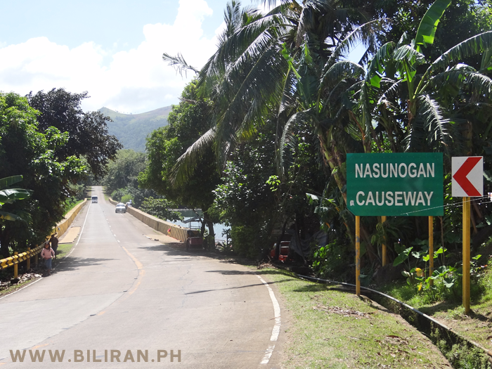
The Nasunogan Causeway that runs between the Biliran Bridge and the mainland of Biliran Island and San Roque barangay.
Biliran BiliranBridge Leyte
 The Nasunogan Causeway that runs between the Biliran Bridge and the mainland of Biliran Island and San Roque barangay. Biliran BiliranBridge Leyte |
|
|
|
Biliran Bridge, by Biliran on Apr 7, 2013 0:42:44 GMT 8, 
Biliran Bridge.
Biliran BiliranBridge Leyte
 Biliran Bridge. Biliran BiliranBridge Leyte |
|
|
|
Biliran Bridge, by Biliran on Apr 12, 2013 20:38:50 GMT 8, 
Panoramic view of Biliran Bridge in Biliran Province.
Biliran BiliranBridge Leyte
 Panoramic view of Biliran Bridge in Biliran Province. Biliran BiliranBridge Leyte |
|
|
|
Biliran Bridge, by Biliran on May 30, 2013 15:00:39 GMT 8, 
A sight that everyone in Biliran Island knows well - The Biliran Bridge.
Biliran BiliranBridge Leyte
 A sight that everyone in Biliran Island knows well - The Biliran Bridge. Biliran BiliranBridge Leyte |
|
|
|
Biliran Bridge, by Biliran on Jun 19, 2013 18:02:53 GMT 8, 
Biliran Bridge is the only road connection between Biliran Island and he main land of Leyte Province.
Biliran BiliranBridge Leyte
 Biliran Bridge is the only road connection between Biliran Island and he main land of Leyte Province. Biliran BiliranBridge Leyte |
|
|
|
Biliran Bridge, by Biliran on Jul 3, 2013 18:27:40 GMT 8, 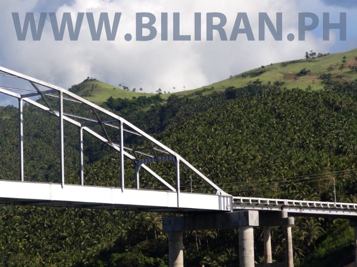
Biliran Bridge.
Biliran BiliranBridge Leyte
 Biliran Bridge. Biliran BiliranBridge Leyte |
|
|
|
Biliran Bridge, by Biliran on Oct 20, 2013 20:01:58 GMT 8, 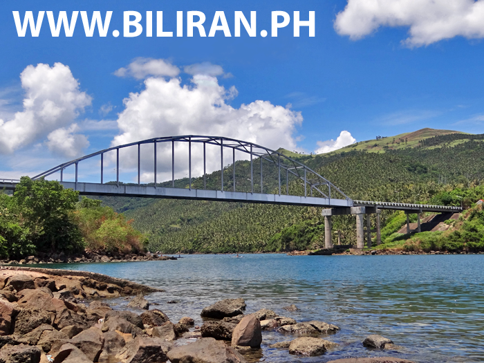
View of the famous Biliran Bridge taken from the small rocky beach on the small Island thats part of the crossing between Biliran island and Leyte Province.
Biliran BiliranBridge Leyte
 View of the famous Biliran Bridge taken from the small rocky beach on the small Island thats part of the crossing between Biliran island and Leyte Province. Biliran BiliranBridge Leyte |
|
|
|
Biliran Bridge, by Biliran on Jun 1, 2014 18:05:42 GMT 8, 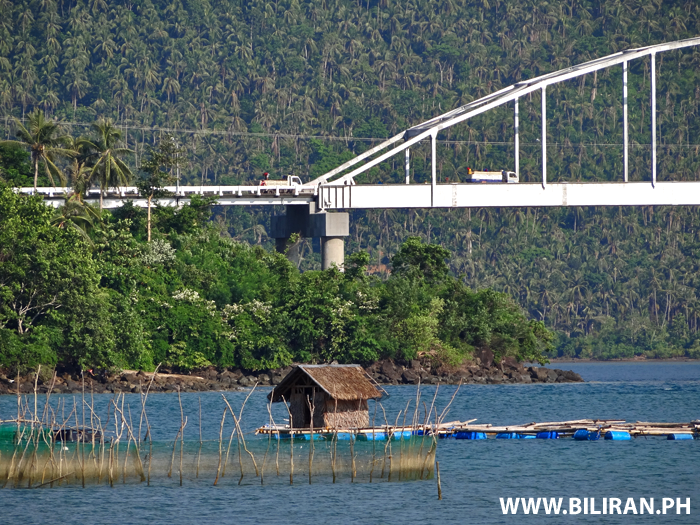
The white colour of the Biliran Bridge stands out so clear against the green of the coconut filled hills of Leyte behind.
Biliran BiliranBridge Leyte
 The white colour of the Biliran Bridge stands out so clear against the green of the coconut filled hills of Leyte behind. Biliran BiliranBridge Leyte |
|
|
|
Biliran Bridge, by Biliran on Jun 10, 2014 20:36:14 GMT 8, 
A wide panoramic photo of Biliran Town and Biliran Bridge.
Biliran BiliranBridge Leyte
 A wide panoramic photo of Biliran Town and Biliran Bridge. Biliran BiliranBridge Leyte |
|
|
|
Biliran Bridge, by Biliran on Mar 15, 2015 23:42:37 GMT 8, 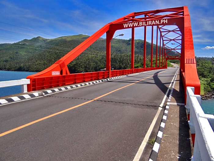
Biliran Bridge.
Biliran BiliranBridge Leyte
 Biliran Bridge. Biliran BiliranBridge Leyte |
|
|
|
Biliran Bridge, by Biliran on Apr 23, 2015 22:12:46 GMT 8, 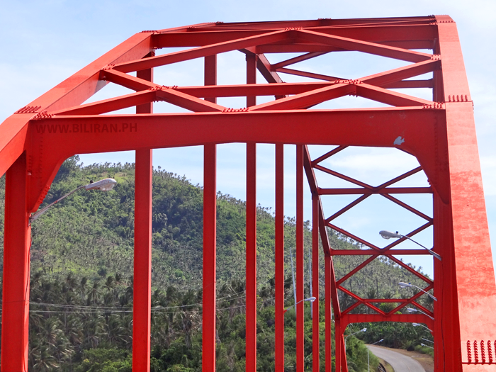
What colour would you paint the Biliran Bridge?
Biliran BiliranBridge Leyte
 What colour would you paint the Biliran Bridge? Biliran BiliranBridge Leyte |
|
|
|
Biliran Bridge, by Biliran on May 15, 2015 19:40:16 GMT 8, 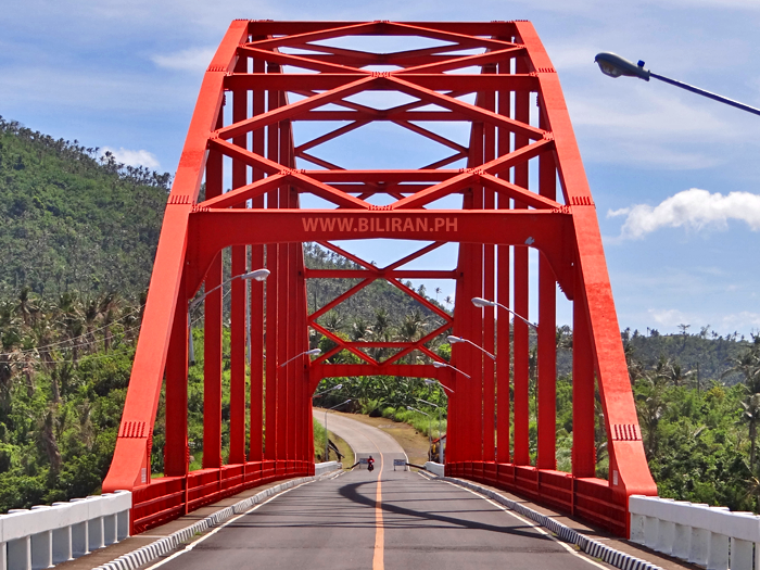
The Biliran Bridge road link between Leyte and Biliran Island.
Biliran BiliranBridge Leyte
 The Biliran Bridge road link between Leyte and Biliran Island. Biliran BiliranBridge Leyte |
|
|
|
Biliran Bridge, by Biliran on May 26, 2015 22:34:12 GMT 8, 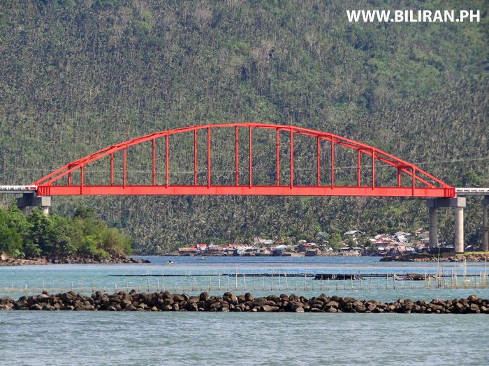
View of the famous Biliran Bridge from Biliran Town.
Biliran BiliranBridge Leyte
 View of the famous Biliran Bridge from Biliran Town. Biliran BiliranBridge Leyte |
|
|
|
Biliran Bridge, by Biliran on Jun 2, 2015 22:10:15 GMT 8, 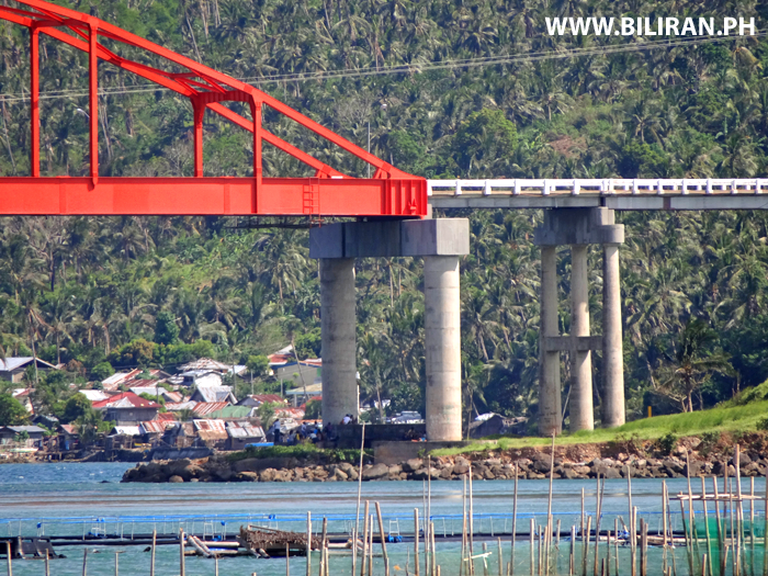
The Biliran Bridge crossing between Biliran Island and Leyte Province.
Biliran BiliranBridge Leyte
 The Biliran Bridge crossing between Biliran Island and Leyte Province. Biliran BiliranBridge Leyte |
|


