GEOTHERMAL GEOLOGY AND REVIEW OF EXPLORATION
BILIRAN ISLAND
www.geothermal-energy.org/pdf/IGAstandard/NZGW/1982/Lawless.pdf.V . LAWLESS* R. C.
ABSTRACT
*Kingston,
National Oil Company
Reynolds, Thom and Allardice Ltd.
Biliran Island has been the subject of a geoscientific exploration programme, and the most promising area is currently being drilled. The first exploratory well has confirmed high temperatures at depth, although it did not encounter significant permeability. The major thermal features of Biliran are located close to a fault, and their
chemistry (acid-sulphate-chloride) indicates an input of magmatic volatiles. It is conjectured that magmatic volatiles are rising on the fault, but that away from this zone a more typical convective hydrothermal system exists. There are similarities to the Krafla Geothermal Field in Iceland.
INTRODUCTION
Biliran Island is located immediately to the north of the Island of Leyte, Republic of the Philippines. Following the successful exploration and development of the Tongonan geothermal field on Leyte, Biliran has been the subject of a continuing geoscientific exploration programme since 1979, culminating in a 3-well deep drilling exploration programme which commenced March 1982. Exploration and drilling has been carried out by the Philippine National Oil Company, with geoscientific and drilling consultative assistance provided by Kingston, Reynolds, Thom and Allardice Ltd., as part of the New Zealand Government Energy cooperation Programme.
Geoscientific techniques suggest the existence of a substantial geothermal reservoir. A commercial resource has not yet been proven by drilling, but preliminary indications are favourable. Of particular interest is the fact that the more prominent surface manifestations are predominantly solfataric, and yet alteration mineralogy from the first drillhole and some of the surface samples points to a neutral-chloride fluid as the alteration medium (A.G. Reyes? pers. comm.). If delineation drilling succeeds in proving the existence of an exploitable neutral-chloride reservoir, this raises the exploration potential of other solfataric areas,
GEOLOGIC SETTING
The tectonic history of Biliran is dominated by its position on the Philippine Fault Zone, which as been the focus of active volcanism and tectonism since the Miocene (Alcaraz 1947). The Philippine Fault is mapped as passing to the west of Biliran, along the coast of the Calubian Peninsula of Leyte. The developed geothermal field of Tongonan, and other prospective areas at Gaas, Burauen and Anahawan, also lie along this zone.
STRATIGRAPHY
Apart from localised thin deposits of reef limestones and marine sediments, the surface geology of Biliran is wholly made up of volcanic rocks and associated volcaniclastic deposits
Biliran-1 drillhole has revealed however, underlying non-volcanic formations. The stratigraphically lowest unit, only encountered in the last of consists of sediments and volcanic breccia, intensely sheared and then subjected to low-grade metamorphism (upper zeolite facies). It may be correlative to metamorphosed sediments and volcanics of Cretaceous age, exposed in Cebu and Samar (Bureau o f Mines 1962). Overlying this is a sequence of fossiliferous clastic and crystalline limestones with intercalated pyritic calcareous shales, Paleontological dating gives an age of Late Miocene to Basal Pliocene and an outerneritic environment. Depositional basins existed both to the east (Samar Basin) and west (Visayan Basin) of Biliran during Miocene-Pliocene times and similar sediments to those encountered in Biliran-1 are now exposed on the adjacent islands of Leyte and Samar.
A thick sequence of volcaniclastic sediments (the Pulang Yuta Formation) occurs above the limestones in BN-1 It is tentatively correlated with similar material (the Panlahuban Formation) exposed in river valleys on the western side of Biliran, but differs in the degree of alteration. The younger volcanic rocks of Biliran have been divided into a number of units based mainly on geomorphic grounds, but with some petrologic distinctions (Espiritu 1980). The volcanic formations of Biliran are predominantly andesitic, with minor quantities of basalt and dacite. They are therefore similar to the volcanic rocks of main-1 and Leyte.
STRUCTURES
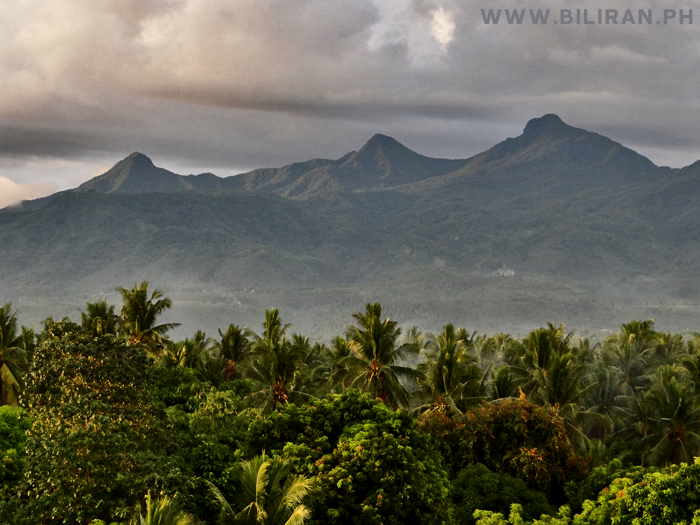
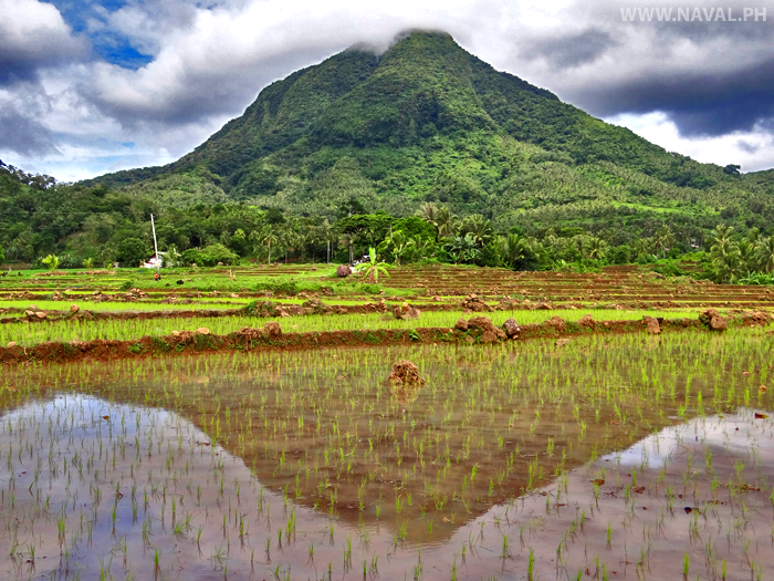
The present day topography of Biliran is made up of a series of coalescing volcanic piles and associated volcaniclastic debris. The degree of erosion of the volcanoes varies, indicating a range of ages, from the deeply dissected composite volcanic massif of Kalambis Ridge to the youthful dacite dome of Mt. Sayao, reputed by local inhabitants to have been historically active (1938).
The general trend of the volcanic centres of Biliran is NW, el to the Philippine Fault Zone (and the Philippine Trench to the east). This volcanic ignment can be traced northward into Luzon, and southwards into Leyte. Similar NW elongation o f the low resistivity anomaly between Vulcan and Kalambis (Figure 2) is noteworthy and may be indirectly caused by a some deep-seated structure perhaps a buried branch of the
Philippine Fault. A major fault (the Vulcan Fault) running NE across Biliran can be recognised, based on topo- graphic lineation and field evidence such as intensely sheared rocks, localised hydrothermal alteration, and alignment of thermal features. Other smaller faults have also been mapped. The most intense thermal activity is located close to the line of the Vulcan Fault, and it is likely that it is acting as a channel for the upflow of
hydrothermal fluid.
Altered ground in the Kalambis and Anas areas is contained within two large 1km2 and 3km2 roughly circular depressions, which are interprete as volcano-tectonic collapse structures. They are not the focus of present-day hydrothermal activity, though weakly-flowing, dilute acid-sulphate springs occur in their vicinities.
GEOCHEMISTRY
Analysis of surface thermal waters and gases divides the Biliran thermal features into 3 geo-chemical types
1. Hot acid-chloride-sul phate fluids
2. Hot or warm acid-sulphate fluids, chloride less than 250 ppm
3. Warm neutral bicarbonate-chloride waters.
The acid-chloridesul phate features are considered to be those closest to the most actively up flowing zones. The acid-sulphate waters are interpreted as steam-heated surface waters, typical o f the higher elevation of geothermal systems. Waters of the third type occur at lower elevations and represent outflow from the geothermal system, diluted with meteoric water and either derived from a neutral-chloride reservoir or neutralised by interaction with country rock. Both the spatial distribution of the thermal features and measured gas ratios are consistent with this interpretation.
Acid-chloride-sul phate fluids are not common features of hydrothermal systems, and their existence here indicates a direct input of magmatic volatiles to the system. This is confirmed by the presence of HC1, HF and SO2 in gas samples, not only from Vulcan and Tenego but also at Libtong and Vulcan Gamay. Additional evidence lies in high ratios (Cope 1982; Glover 1981).
The chemistry of Biliran thermal features means that conventional sol geothermometers cannot be usefully applied. Gas geothermometers give a wide range of results, probably indicating natural variations as well a s sampling and
analytical error.
THERMAL MANIFESTATIONS
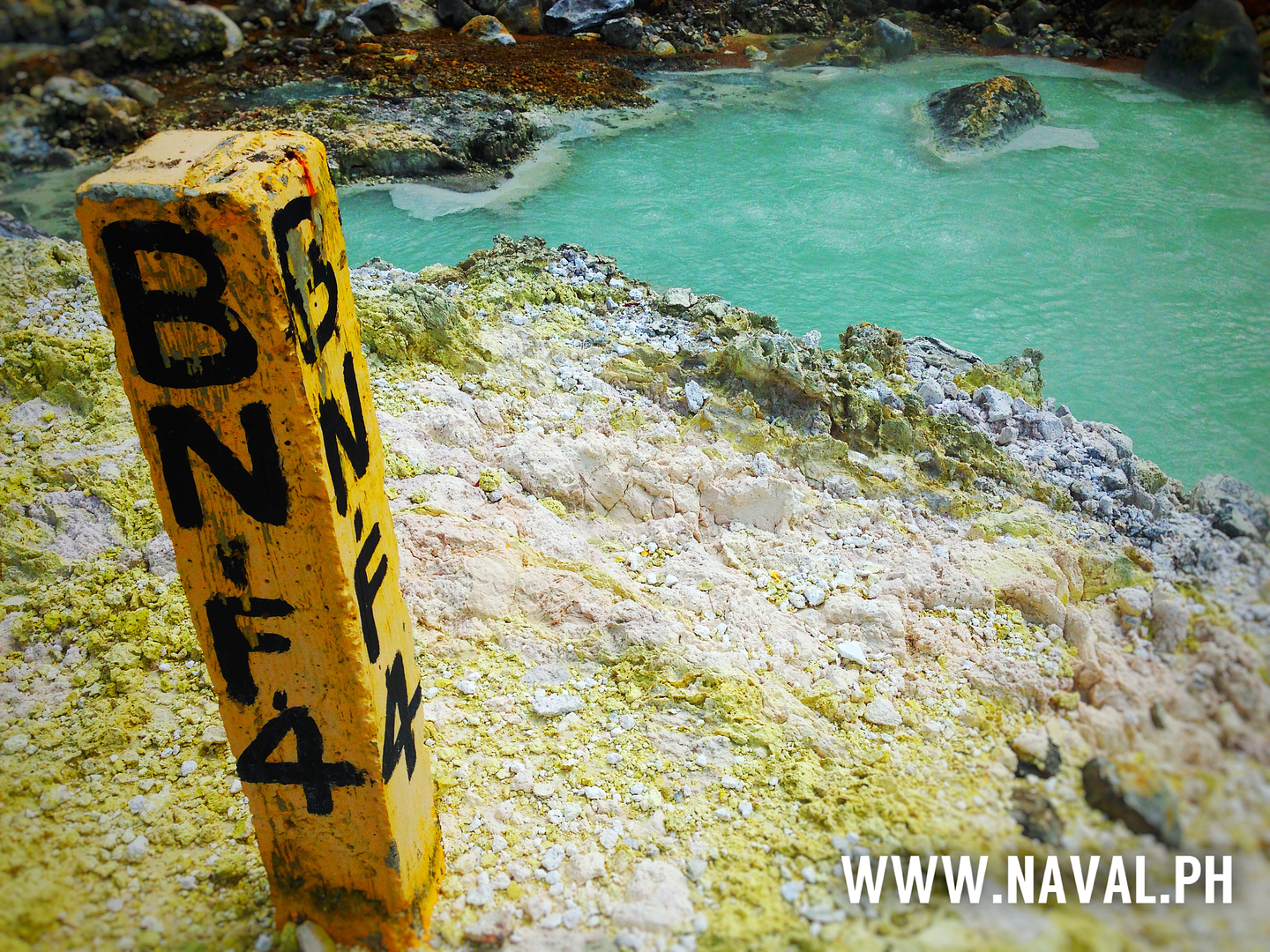
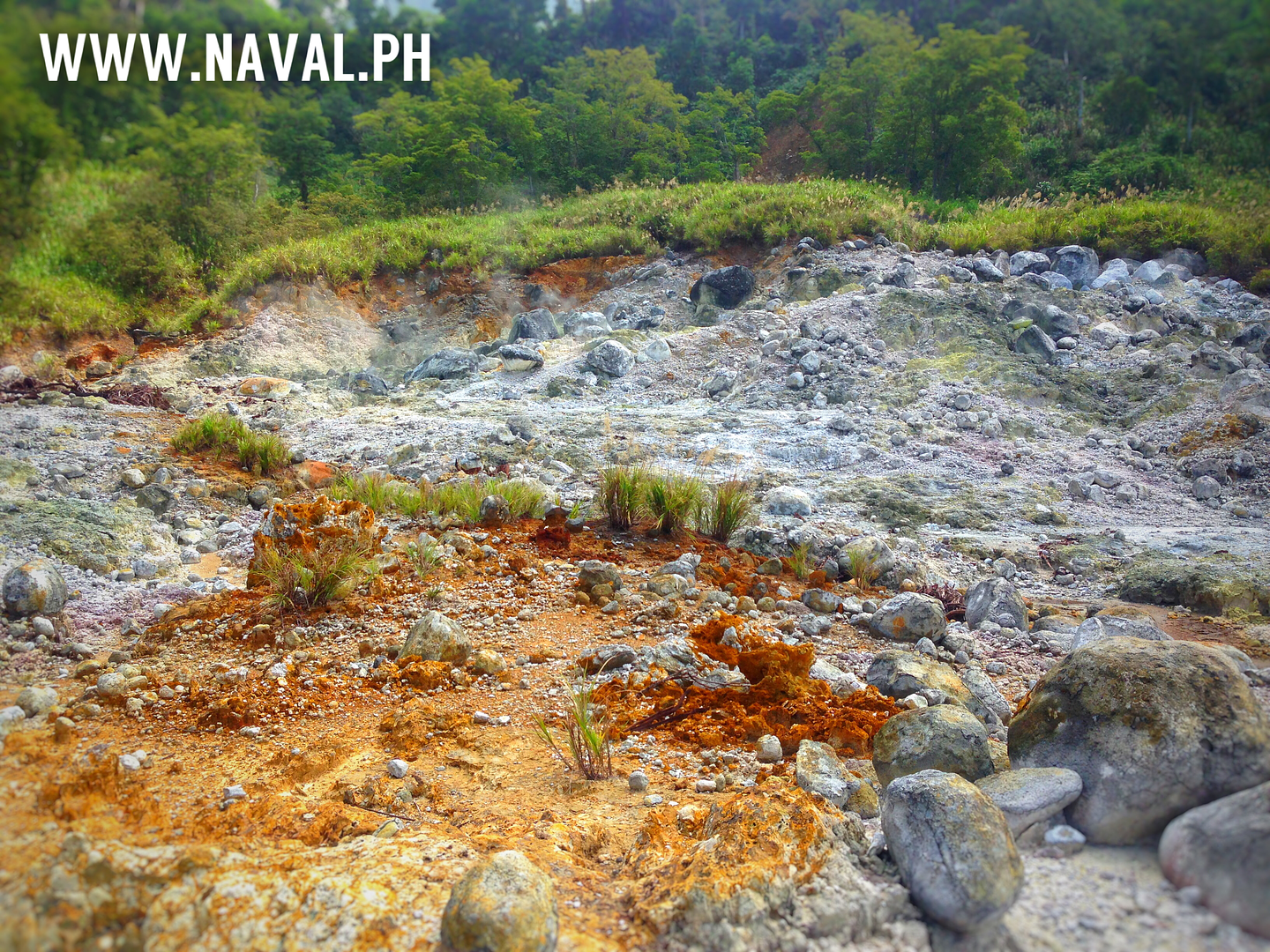
The most impressive thermal features on Biliran are in the Vulcan thermal area, consisting of boiling pools, mudpools and mildly superheated steam vents (Figure 2). There is a large flow of gas, and much sulphur has been deposited around the vents. An unusual feature is a mudpool which emits material containing 75% sulphur with natroal unite and traces of gypsum and opaline silica, forming lava-like flows u p t o 500 m long and 1-2 m thick.
There are smaller areas of boiling springs and steam vents at Libtong and Vulcan Gamay. The most active thermal features o f Biliran lie in a broad N E belt approximately paralleling the Vulcan Fault. Warm <60 springs occur at several locations, in addition to a number of cold but mineralised seepages, some of which emit small quantities of gas.
HYDROTHERMAL ALTERATI0N
Areas of intense acid alteration surround the active thermal areas. Typical assemblages are cristobalite gypsum-sulphur kaolinite-hematitepyrite, natroalunite, quartz, leucoxene and sulphate?. In addition, there are large areas of altered ground not related to present-day thermal activity, with generally similar mineral assemblages. Occasional surface samples, however, have mineralogy more typical o f neutral-chloride alteration (for example illite-montorillonite from the Vulcan area - T.M. Leach pers.comm.
In part alteration must be relict, as shown by the presence of high temperature phases (e.g. pyrophyllite, epidote) now occurring on the surface.
In contrast, cores and cuttings from the first deep drillhole (BN-1 with a total depth 2425 m), reveal that acid alteration is minor and restricted to the upper portion (down t o 114 m). Below this level clasts within the Pulang Yuta Formation have varying degrees and ranks of alteration, but examination of the groundmass and fine-grained material shows that the latest phase of alteration to produce an assemblage of chlorite-illite-mont-morillonite-vermiculite and interlayered clays, plus calcite-quartz, with minor gypsum, hematite
and pyrite and traces of epidote. This assemblage is more typical of medium temperature (120-200) alteration by a neutral -chloride fluid. However, temperatures predicted on the basis of alteration mineralogy have proved to be lower than measured downhole temperatures, and so may not be a reliable indicator of present conditions in the reservoir.
GEOPHYSICS
Biliran has been surveyed using a combination of Schlumberger traversing, dipole-dipole, and vertical electrical sounding resistivity techniques. Results of Schlumberger traverses with AB/2 spacing of 500 m are shown in Figure 3 as iso resistivity contours . In general the more-deeply-penetrating techniques have tended to support the Schlumberger results, but have added significant information by revealing that low-resistivity anomalies are
connected a t depth beneath the fresh, unaltered young volcanics of Mts. Sayao and Tamburok
The resistivity pattern is interpreted as indicating a geothermal reservoir centered approx-imately on the Vulcan Gamay area, and with out- flow to the east and west. The low-resistivity anomaly between Vulcan and Kalambis may also be anoutflow, or it may be a separate zone of upwelling
RESULTS OF EXPLORATION DRILLING
At the time of writing, June 1982, the first of 3 planned deep exploration wells, BN-1 had recently been completed to a depth of 2425 This well is located to the north of the Vulcan surface manifestations and, although hot, appears have to limited permeability. Nevertheless it has provided useful geological information,
particular, evidence for neutral -chlorideteration. The major part of the well passed through a thick volcano-sedimentary unit (the Pulang Yuta Formation). This unit was not recognized on the surface and its thickness was unexpected. After penetrating the Pulang Yuta Formation, a gas kick was experienced within the underlying sediments indicating high formation pressures and that the relatively impermeable Pulang Yuta Formation was acting as a cap. Gas (predominantly CO2 with no distinctive magmatic component) was successfully circulated out and the well now stands with zero wellhead pressure.
The limited permeability suggested by the lack of circulation losses during drilling is consistent with results obtained during injectivity testing at low flowrates. However, at higher flow rates the injectivity improved, possibly indicating formation breakdown. The well is still heating (maximum bottomhole temperature = 254, as of 3/7/82 and an attempt will be made to discharge it in the near future.
CONCEPTUAL MODELS OF THE BILIRAN SYSTEM
Two alternative models have been developed to described the Biliran geothermal system. They can
be sumnarised as follows:
1) Thermal features in Biliran are the result of the direct upflow of magmatic volatiles, mixing with groundwater to produce a hot, acid fluid. The centre of upflow is near the Vulcan thermal area. Outflow of mixed fluid and condensate, and hydrothermal alteration by the outflowing fluid, produce the observed low-resistivity anomaly .
2) A magma chamber or intrusive at depth conductively heats meteoric water, giving rise to a convective hydrothermal system. Within this system, high-permeability channels along faults permit the local upflow of magmatic volatiles, producing restricted zones of acid fluid , However, the bulk of the system consists of
chloride fluid , as is commonly encountered in other convective hydrothermal systems, and this is responsible for the observed low resistivity.
If the first of these hypotheses i s correct, then the area may be underlain by an acid, corrosive fluid, a similar situation to that encountered at Tatun geothermal field, Taiwan (Chen 1970). In this case the area could not be exploited using conventional geothermal If the second model applies, then there is a much better chance of developing an exploitable resource. There may be acid zones within the field which will have to be avoided, but the rest of the reservoir can be drawn upon. A similar situation exists in Krafla field, Iceland
(Armansson et al 1981 where magmatic volatiles arise along a linear structural feature producing acid conditions, but are surrounded by a neutral-chloride reservoir,
On balance, the second model o f Biliran is favoured for the following reasons:
- evidence of neutral- chloride alteration in some surface samples.
- evidence of neutral chloride alteration throughout most o f BN-1.
- an i n d i c a t i o n on interpreted VES/dipole sections of 2 separate low -resistivity layers: a shallow one presumably corresponding to acid condensate, and a deeper one which may represent the neutral reservoir
(Figure 3).
- restriction of acid-chloride water in surface features to those along the line of the Vulcan fault.
CONCLUSIONS
Geoscientific exploration and drilling has not yet proven the existence of an exploitable geothermal
resource on Biliran but indications are promising. The presence of a magmatic component in outflow from surface thermal features is a cause for concern, as it may indicate the existence of acid conditions at depth. However, by analogy with other explored geothermal is probable that acid conditions are restricted to localised upflow zones.
Investigation of the area is continuing.
ACKNOWLEDGEMENTS
This paper has drawn on a number o f unpublish-ed PNOC, KRTA and DSIR reports, and their contribution is gratefully acknowledged. Thanks are due to PNOC for permission t o publish exploration data and support in the preparation and presentation this report. Our appreciation is also extended the many colleagues in PNOC and KRTA who have collaborated on the Biliran Project.
REFERENCES
Alcaraz, A.P. 1947. The major structural lines
of the Philippines The Phili ine
Geologist, 1 (2):
Armansson, H.; Gislason, G.; Hauksson, T. 1981.
Magmatic gases i n well fluids aid the
mapping o f the flow pattern i n a geothermal
system. Geochemica e t Cosmichimica
Acta ( i n press).
Bureau o f Mines 1962. Geological map o f the
Phi1 ppines , scale 1:1000000
Chen, C.H. 1970. Geology and geothermal power
potential of the Tatun volcanic region.
(Geothermics 2 (2): 1134.
C.M. 1982, Further studies on B i l i r a n aas
chemistry Proceedings o f 4th Annual
EDC Geoscientific Conference,
April 1982.
D'Amore F., Panichi, C. (1980). Evaluation of
deep temperatures o f hydrothermal systems
by a new gas geothermometer Geochemica e t
Cosmochimica Acta 44: 549-556.
Espiritu, D.D. 1980. Geology o f Biliran Island
Galia, Clemente, V.C. 1980. Geochemistry
(Report 2). PNOC-EDC unpublished report,
o f B i l i r a n gas and water samples and i t s
geothermal significance PNOC-EDC
unpubl ished report.
over, R. B. 1981. Geochemical report: DSIR
Mission t o the Philippines. Unpublished
DSIR report,
Vasquez, N.C., Tolentino, B.S. 1972. The Geology
o f the Tongonan Geothermal Field


