|
|
Naval Biliran Maps, by Biliran on Jan 18, 2013 23:10:38 GMT 8, 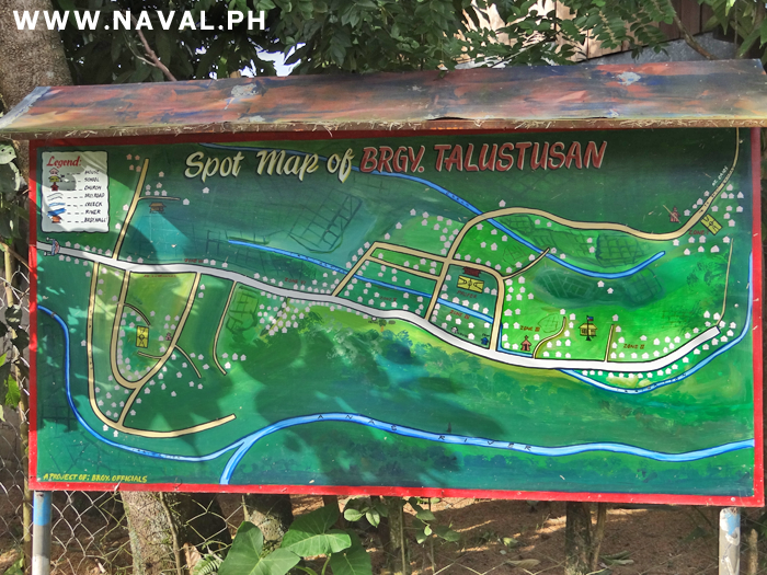
Map of Talustusan Barangay that is part of Naval Municipality, Biliran Province.
 Map of Talustusan Barangay that is part of Naval Municipality, Biliran Province. |
|
|
|
Naval Biliran Maps, by Biliran on Jan 18, 2013 23:18:34 GMT 8, 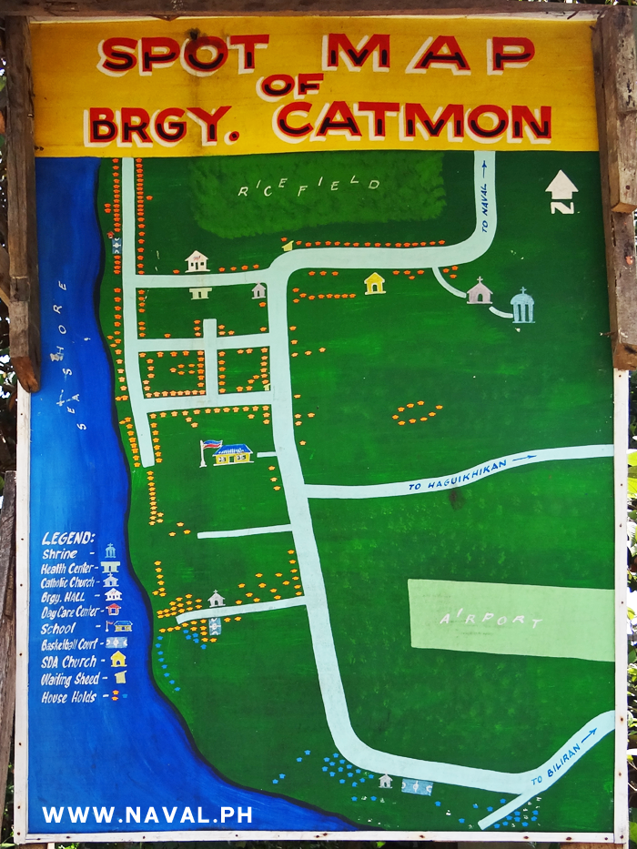
Map of Catmon Barangay, part of Naval Municipality, Biliran Province.
 Map of Catmon Barangay, part of Naval Municipality, Biliran Province. |
|
|
|
Naval Biliran Maps, by Biliran on Feb 18, 2013 19:45:21 GMT 8, 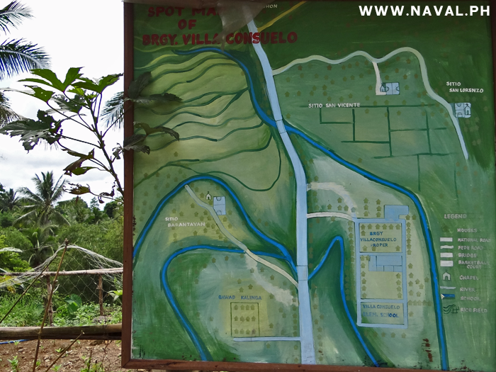
Map of Villa Consuelo Barangay, part of Naval Municipality, Biliran Province.
 Map of Villa Consuelo Barangay, part of Naval Municipality, Biliran Province. |
|
|
|
Naval Biliran Maps, by Biliran on Feb 26, 2013 22:53:36 GMT 8, 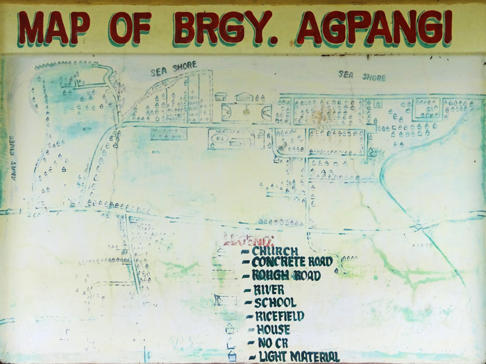
Map of Agpangi Barangay, Naval Municipality, Biliran Province.
 Map of Agpangi Barangay, Naval Municipality, Biliran Province. |
|
|
|
Naval Biliran Maps, by Biliran on Aug 14, 2013 0:40:25 GMT 8, 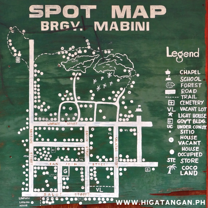
Higatangan Map of Mabini Barangay.
 Higatangan Map of Mabini Barangay. |
|
|
|
Naval Biliran Maps, by Biliran on Jun 27, 2014 22:14:08 GMT 8, 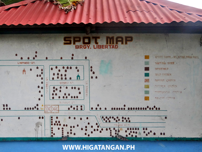
Libertad Barangay Map, Higatangan Island, Biliran Province.
 Libertad Barangay Map, Higatangan Island, Biliran Province. |
|
|
|
|
|
Naval Biliran Maps, by Biliran on May 18, 2015 21:49:22 GMT 8, 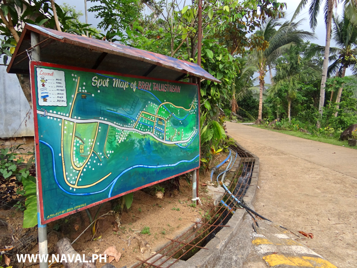
Spot Map in Talustusan Barangay, Naval, Biliran Province.
 Spot Map in Talustusan Barangay, Naval, Biliran Province. |
|
|
|
Naval Biliran Maps, by Biliran on Mar 26, 2016 21:28:56 GMT 8, 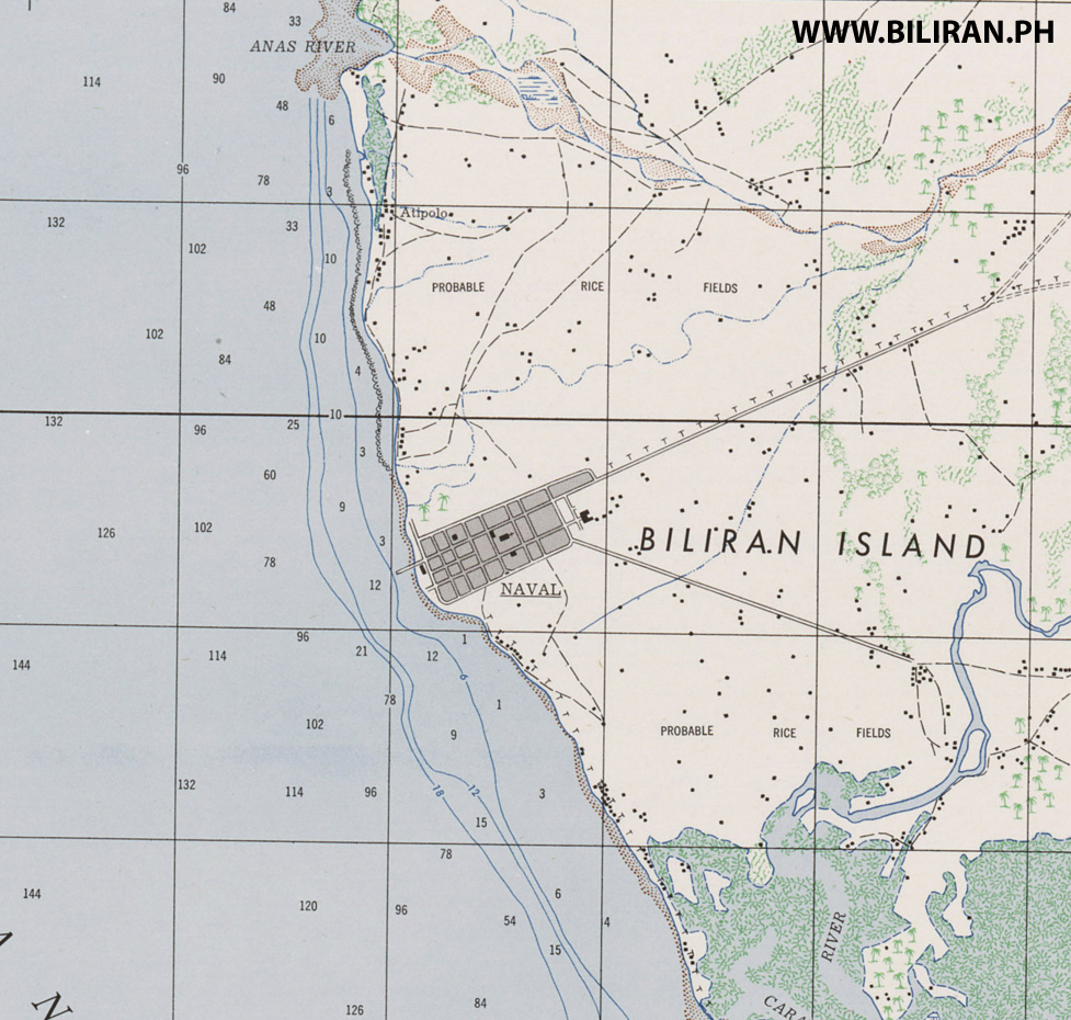
Very interesting WW2 map produced by US forces of Naval town on the west coast of Biliran Island.
Clearly showing Naval Town and Atipolo to the north and the Sto. Nino area to the south and the Caraycaray River.
 Very interesting WW2 map produced by US forces of Naval town on the west coast of Biliran Island. Clearly showing Naval Town and Atipolo to the north and the Sto. Nino area to the south and the Caraycaray River. |
|
|
|
Naval Biliran Maps, by Biliran on Mar 26, 2016 21:43:14 GMT 8, 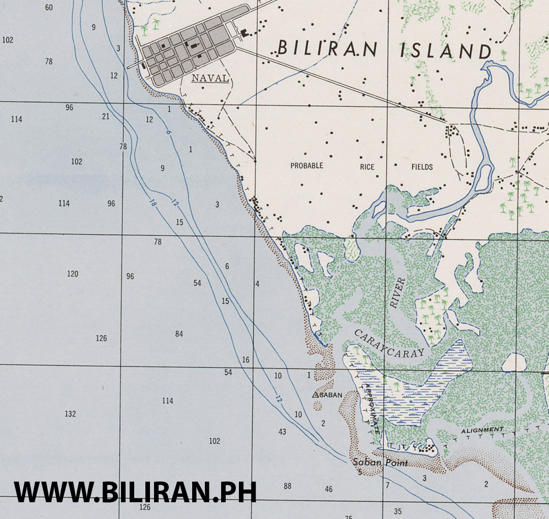
An old WW2 map produced by American Forced showing the area south of Naval Town such as Sto. Nino and the mangrove area of the Caraycaray River.
 An old WW2 map produced by American Forced showing the area south of Naval Town such as Sto. Nino and the mangrove area of the Caraycaray River. |
|
|
|
Naval Biliran Maps, by Biliran on Mar 26, 2016 22:32:20 GMT 8, 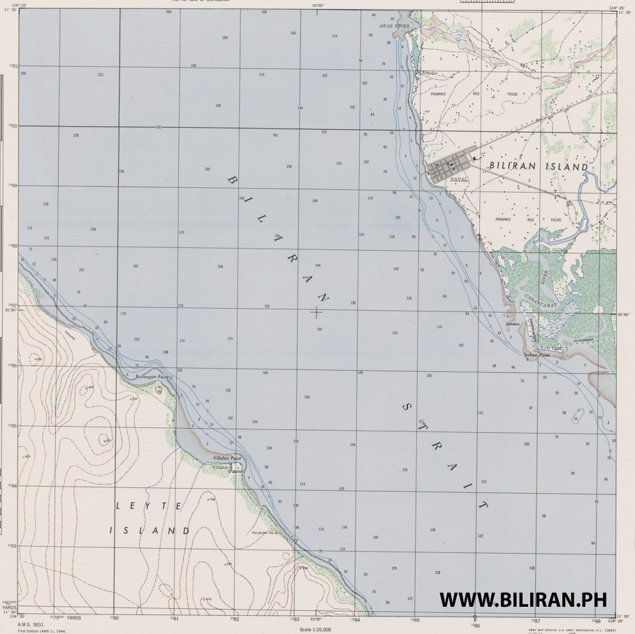
WW2 Map showing Naval Town on Biliran island and the Biliran Strait with Villalon across the water in Calubian Municipality in Leyte Province.
 WW2 Map showing Naval Town on Biliran island and the Biliran Strait with Villalon across the water in Calubian Municipality in Leyte Province. |
|


